One way of figuring out what we need to work on right now is to dream big about what a bright future would look like. DTNA ’s Vision 2030 started as immediate plans for activating the pandemic-era Noe Slow Street, but with that street now permanent, it has expanded to a vision of how it connects to the rest of the streets in the Triangle and beyond.
We know that whatever percentage of Triangle residents are still driving cars in 2030 (it ’s less than half of us now) those cars will be mostly electric, as California is phasing out gas-powered vehicles. We also know that even those of us who drive cars sometimes also ride an electric scooter, or an e-bike, or a bike bike, or we walk. Vision 2030 imagines the Triangle as a space where all those uses can happen seamlessly and safely together, at low speeds, quietly, and respectfully of both residents and the other modes of transportation. As a Spanish urban planner once remarked, “all the modes of transportation are equal. But the pedestrian is the most equal of all.”
But what about beyond the Triangle? Noe Street is not the only slow street in the city, and when we leave our houses our destinations are often in other neighborhoods, sometimes even in other cities (for example, I commute by bike and BART 35 miles each way to Lafayette every day of the week). How can we make our routes to the wider world as safe and seamless as the ones we are imagining for our local spaces?
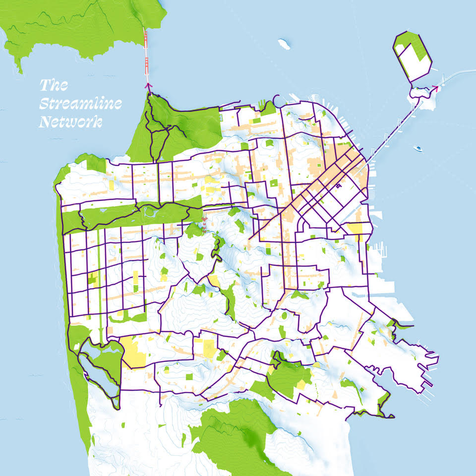
It ’s only in the initial planning phases, but some bold visionaries have already started sketching out a city-wide map of bike and scooter routes that link the Slow Streets together. Right now the maps serve as rough guides, much like the celebrated Crosstown Trail that links parks and open spaces from the southeast to the northwest into one seamless hike. But the potential is there for more. Maybe not by 2030, but by 2050? We can all dream of a utopian future at least.
But the arc of history does not bend toward utopia on its own – it only bends that way because we get together in communities and make it happen – so join up with the folks working on this. SF Parks Alliance and “The People’s Slow Streets” has the most ambitious, one that would connect Duboce Triangle to every neighborhood in San Francisco, including the far-flung southern parts of the Excelsior and Bayview in a 100-mile network of slow streets. SFMTA is beginning a process to work on this as well, and has their own map. City processes can be slow and cumbersome, but if dedicated citizens keep pushing their elected officials and the bureaucrats whose salaries we pay to move in the right direction, things do eventually get done.
If you have any ideas for how the Triangle specifically can improve its contribution to the bike network (the main east/west corridor The Wiggle goes right through the heart of our neighborhood) and how DTNA can work to help connect our neighborhood to other neighborhoods by any means of transportation, contact us at dtna.org. And most importantly, get involved. Utopia is coming soon, to a neighborhood near you, but only if we work for it. Let ’s go!
Some bold visionaries have already started sketching out a city-wide map of bike and scooter routes that can link the Slow Streets together.